The 3D viewer
Since 2018, the Geoportal has included a 3D component that allows users to explore Luxembourg in three dimensions. This first version was limited to passive visualisation of the 3D model data and Geoportal layers, without offering any possibilities for interacting with the data. After seven years of operation, the underlying technology has become obsolete.
In order to meet the changing needs of users, the Land Registry and Topography Administration has completely redesigned the 3D approach and integrated an innovative open source tool into its Geoportal: "Virtual City Map".
This tool integrates all of the Geoportal's public layers and offers a wide range of tools for interacting with 3D data.
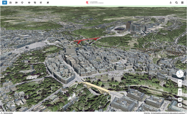
Illustration of the new 3D viewer with a view of Luxembourg's old town
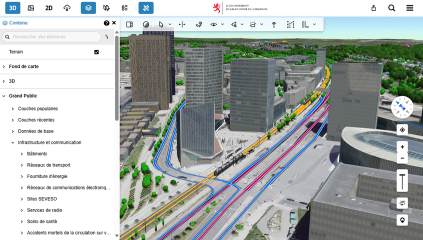
Illustration of a combined view of 3D objects with the 2D layer of public transport lines projected onto the terrain
The display of three-dimensional data is now smoother and its graphic quality far exceeds that of the initial 2018 version.
But this development is not limited to simple performance optimisation: the viewer also includes oblique images and highly advanced interaction tools.
Accessible to all via 3d.geoportail.lu, the new viewer allows users to combine terrain relief and 3D objects, such as buildings, while superimposing nearly 1,000 layers of public data already available in 2D. This wealth of information is made possible by the central role of the Geoportal as the official platform for geodata from the Luxembourg State.
Beyond simple visualisation, the new viewer introduces a multitude of features that open up new perspectives for spatial analysis and urban planning. It is now possible to simulate the shadows cast by existing buildings based on the position of the sun, a feature that is particularly useful for assessing the amount of sunlight a site receives with a view to installing a photovoltaic system. This feature can be combined with the creation of volumes representing future constructions, making it possible to test development scenarios and carry out visibility analyses.
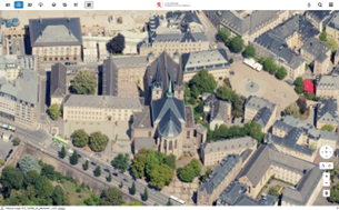
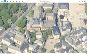
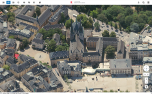
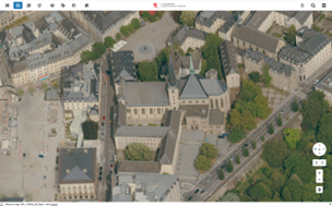
Oblique imagery
In addition to the 3D view shown above, the new viewer also includes oblique imagery display. The texturing of 3D building facades was the main objective of these oblique shots taken in 2023. However, these perspectives are of particular interest for analysing and understanding the territory. This is why the Land Registry and Topography Administration also makes these images available in the viewer, allowing users to benefit from a complementary view from four directions (north, west, south and east).